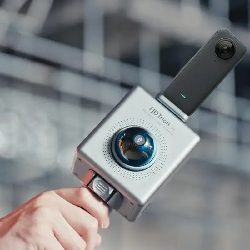
Introduction: The Power of 3D Handheld LiDAR Scanners
In recent years, 3D handheld LiDAR scanners have transformed the way professionals capture and analyze spatial data. Unlike traditional surveying methods, these portable scanners provide a fast, accurate, and flexible way to create detailed three-dimensional maps. By integrating SLAM (Simultaneous Localization and Mapping) technology, users can achieve real-time 3D mapping even in complex environments.
Whether you are an architect, urban planner, archaeologist, or robotics enthusiast, understanding how to effectively use a 3D handheld LiDAR scanner for SLAM can enhance productivity and improve project outcomes. In this article, we will explore everything from the fundamentals of LiDAR scanning to practical tips, applications, and guidance for buying the right device.

What is a 3D Handheld LiDAR Scanner?
A 3D handheld LiDAR scanner is a portable device that emits laser beams to measure distances to objects, generating precise point clouds that represent the environment. These scanners can capture millions of points per second, creating highly detailed 3D models suitable for analysis, design, and documentation.
Shop Now!Key Features of 3D Handheld LiDAR Scanners
- Portability and Ergonomics: Lightweight and easy to carry, suitable for both indoor and outdoor scanning.
- High Precision: Capable of capturing minute details with centimeter-level accuracy.
- Real-Time Visualization: Many models allow users to view 3D point clouds in real time.
- Software Compatibility: Data can be exported to CAD, BIM, or GIS platforms for detailed analysis.
These features make handheld scanners ideal for users who need a versatile and reliable solution for 3D mapping.
Understanding SLAM and Its Role in 3D Mapping
SLAM (Simultaneous Localization and Mapping) is a computational technique that allows a device to map an unknown environment while simultaneously tracking its own location within that map.
When combined with a 3D handheld LiDAR scanner, SLAM enables:
Real-Time Mapping:
Users can instantly visualize the scanned environment.
Autonomous Navigation:
Devices can scan complex spaces without external GPS or tracking systems.
High Accuracy:
SLAM algorithms continuously correct positional errors, resulting in precise maps.
SLAM is especially beneficial in GPS-denied environments such as indoor spaces, tunnels, or dense urban areas, ensuring continuous and reliable mapping.
How to 3D Map Using SLAM with a 3D Handheld LiDAR Scanner
Step 1: Preparing the Environment
Before scanning, ensure the area is accessible and safe. Remove obstacles that may block the laser or interfere with scanning. Define the scanning route to optimize coverage and minimize overlap or missed areas.
Step 2: Setting Up the Scanner
- Fully charge your 3D handheld LiDAR scanner.
- Power on the device and ensure the companion software is ready for data collection.
- Calibrate the scanner if necessary, following the manufacturer’s instructions to ensure accuracy.
Step 3: Performing the Scan
- Move the scanner steadily to maintain consistent data capture.
- Monitor real-time point clouds to ensure all critical areas are scanned.
- Avoid rapid movements or abrupt tilting that can cause distortion in the 3D map.
Step 4: Processing the Data
- Export the collected point cloud data to compatible software.
- Clean up noise and merge multiple scans if required to create a complete 3D model.
- Use the processed 3D data for measurement, analysis, or 3D modeling purposes.
Applications of 3D Handheld LiDAR Scanners with SLAM
Architecture and Construction
Architects and engineers can use 3D handheld LiDAR scanners to create accurate as-built models, validate measurements, and plan renovations. SLAM-enabled scanners reduce the time needed for site surveys while improving precision.
Urban Planning
City planners benefit from detailed 3D urban models, which can aid infrastructure planning, road design, and public space management. SLAM allows mapping even in areas with poor GPS signals.
Archaeology
Documenting historical sites is easier with portable LiDAR scanners. High-precision 3D models preserve structural details and support research and conservation.
Robotics and Automation
Autonomous robots rely on accurate 3D maps to navigate safely. SLAM-enabled handheld LiDAR scanners can provide the reference data necessary for robotics testing and simulation.
Environmental Monitoring
LiDAR scanning is valuable for analyzing vegetation, topography, and forest canopy structures. It supports sustainable environmental management and resource planning.
Choosing the Right 3D Handheld LiDAR Scanner
When selecting a scanner, consider:
- Scanning Range and Accuracy: Ensure it meets the demands of your project.
- Battery Life: Longer battery life allows extended fieldwork.
- Data Export Options: Compatible with CAD, BIM, or GIS software.
- Portability and Ergonomics: Lightweight models reduce fatigue during long sessions.
- Budget: Invest in a model that balances features and cost-effectiveness.
Tips for Optimizing 3D SLAM Scans
- Maintain a consistent speed while moving the scanner.
- Avoid reflective or transparent surfaces to reduce errors.
- Plan scanning paths carefully to minimize missed areas.
- Perform regular calibrations to ensure ongoing accuracy.
Buying and Using 3D Handheld LiDAR Scanners
If you are interested in acquiring a 3D handheld LiDAR scanner, consider models with built-in SLAM and real-time point cloud visualization. High-quality scanners provide reliable performance for professional or personal use. Look for devices that are lightweight, easy to operate, and designed for long scanning sessions.
Investing in a capable scanner can save time, increase accuracy, and enhance the quality of 3D mapping projects. Scanners are available for sale through reputable suppliers and come with warranties and customer support to ensure optimal performance.
Conclusion
The combination of SLAM and 3D handheld LiDAR scanners has revolutionized 3D mapping across multiple industries. From architecture and urban planning to robotics and environmental monitoring, these devices provide precise, real-time mapping capabilities that simplify complex projects. By choosing the right scanner, following proper scanning techniques, and understanding the underlying SLAM technology, users can achieve professional-grade results efficiently.