Construction site survey is a vital part of Architectural, Construction, and Engineering (AEC) projects. However, traditional surveying approaches frequently face difficulties that could impede progress. The mobile LiDAR scanner has made construction site surveys more efficient and accurate. It merges laser scanning with versatility to reduce the need for traditional survey techniques. This helps lower costs, minimize human errors, and speed up project timelines. In this article, we will explain what is mobile LiDAR scanner and how it enhances the site survey in construction.
What Is Mobile LiDAR Scanner?
In the fast-paced world of AEC projects, efficiency and accuracy are key. That's where mobile LiDAR scanner comes in, becoming an important tool for professionals. This tool makes project planning and execution easy. It gives you precise measurements and generates accurate 3D models.
Born from complex SLAM (Simultaneous Localization and Mapping) algorithms, mobile LiDAR scanner offers an accurate 3D point cloud. It excels in motion and relies on environmental features to map an area with confidence. TLS (Terrestrial Laser Scanner) relies on static positioning, which limits its flexibility. Mobile LiDAR is more versatile than TLS because it doesn't need a fixed position and is lightweight.
The mobile LiDAR scanner uses advanced technology for construction projects in an efficient way. It is designed to be easy to use and provides precise results.
Improving Construction Site Survey: How Mobile LiDAR Scanner Works
In recent years, mobile LiDAR scanners have transformed the way we conduct site survey in construction. This innovative method not only improves efficiency and accuracy but also enhances safety on the job site. In this part, we will discuss how the advanced tool improves site survey in construction:
Uncovering potential issues
Clash detection plays a pivotal role in surveying, thereby preventing unnecessary rework. This is due to its ability to pinpoint any issues or disputes involving building components. Mobile LiDAR equipment generates precise and intricate 3D data. It enables surveyors to merge this info with the building designs fabricated using BIM software. By doing so, potential clashes between the design and the existing site conditions can be identified and addressed before construction commences. In other words, clash detection ensures that conflicts are resolved proactively. Thus, it minimizes the need for extensive rework and costly delays.
Optimizing site planning
Mobile LiDAR scanner accelerates the collection of comprehensive data about a construction site. This wealth of information will lead to improved site planning and optimization. The gathered 3D data is particularly useful in identifying optimal locations for buildings, roads, or utilities. By optimizing the site layout and planning, construction efficiency is enhanced. As a result, material waste is reduced and your productivity is increased. Furthermore, its reliable and easily repeatable data capture method ensures that up-to-date site data is always available for surveyors.

Bringing projects to life
The increasing prevalence of 3D modeling and simulations in the AEC sector can be attributed to multiple factors. Mobile LiDAR-generated 3D models help identify energy shortcomings in buildings through sunlight and shadow analysis, aiding architects in optimizing renovation projects. Furthermore, virtual walkthroughs are made possible by mobile LiDAR scanner. Then it provides stakeholders with remote access to sites when necessary. These benefits have contributed to the extensive adoption of 3D models and simulations in the AEC community.
Breaking down barriers to entry
Accessibility is also a critical factor in many construction projects. Collecting site data from hard-to-reach or risky areas can be tough using traditional methods. But mobile LiDAR scanners offer an ideal solution for that. They enable remote data collection with ease without putting surveyors in danger. These scanners can get information from challenging locations, which can help with later projects. Because the measurements are precise and comprehensive, leading to better decision-making during your construction site survey.
What Sets Mobile LiDAR apart from Other Data Capture Methods?
The diverse methods for data capture mentioned earlier often collaborate to achieve a common goal. The mobile LiDAR scanner aims to streamline this process by offering a versatile tool capable of performing multiple tasks to an exceptional standard. The FJD Trion, among other mobile LiDAR devices, demonstrates these benefits:
Speedy data capture
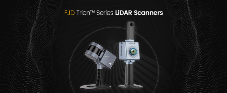
FJD Trion S1 mobile LiDAR scanner boasts an impressive speed, processing 320,000 points per second. Thus, it allows for efficient and accurate data capture in both simple and complex environments. This feature significantly reduces the time required for high-quality scans, enhancing overall productivity.

Convenience on-the-go
Portability is a key aspect of the mobile LiDAR scanner. It is designed to be lightweight and portable, enabling users to move around freely while scanning. FJD Trion S1 is equipped with a rotating LiDAR sensor that provides a broad field of view. It features a compact size and user-friendly design, being simple and convenient to use.
Accurate results every time
The mobile LiDAR demonstrates exceptional accuracy in its 3D scanning capabilities. And it achieves survey-grade precision of centimeter-level depending on the environment. This level of accuracy ensures comprehensive and precise results. So it helps to capture every detail with remarkable accuracy.
Versatile tool for multiple tasks
The FJD Trion S1 is a highly versatile 3D mobile LiDAR scanner, boasting a range up to 120 meters. This allows for flexible usage in a variety of environments such as outdoors, indoors, or underground. It can be easily mounted onto a backpack or a vehicle, making it suitable for diverse applications.

Final Thoughts
The integration of advanced technologies in the construction sector is heralding a bright future for surveying, with mobile LiDAR scanner making substantial strides in accessibility, versatility, and cost-effectiveness. As technology advances, the construction industry is likely to witness even more remarkable improvements in the implementation of mobile LiDAR.
In conclusion, mobile LiDAR is a powerful tool for streamlining your construction site survey. It offers a level of accuracy and efficiency that was before unattainable with traditional methods. Therefore, it is ideal for use on large-scale projects. The future of the construction industry looks brighter for these advanced technologies. So it is clear that mobile LiDAR will continue to shape the way we conduct site surveys in the years to come. So why not try a mobile LiDAR scanner like FJD Trion now?


