


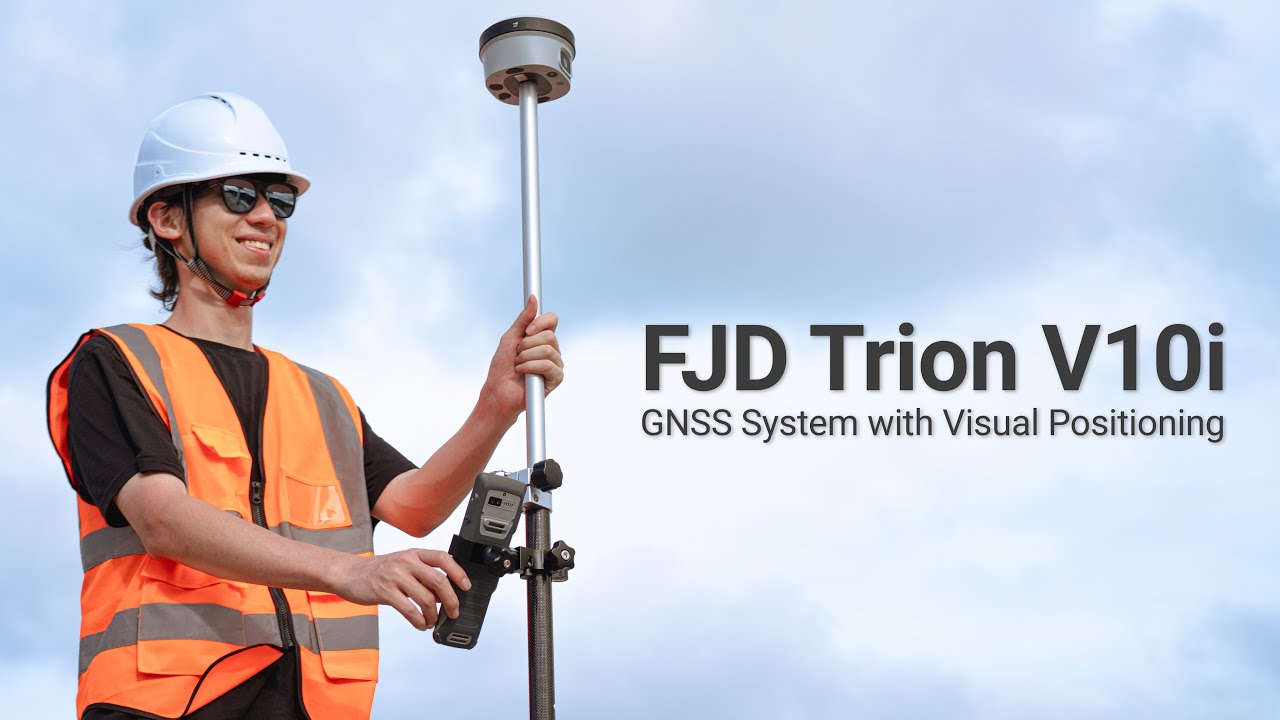
FJD Trion V10i RTK GNSS Receiver with Visual Positioning System
Tax excluded. Taxes and Shipping calculated at checkout
*For regions unable to place an order, please contact us for help.


Capture More, Worry Less
Features

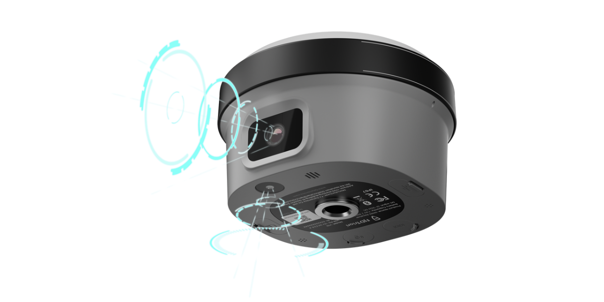
Global Shutter: 2MP & 5 MP
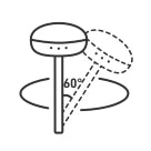
Max tilt 60°, Calibration-free

IP68, 2m Drop-proof

H: 8 mm + 1 ppm RMS
V: 15 mm + 1 ppm RMS

1408 Channels

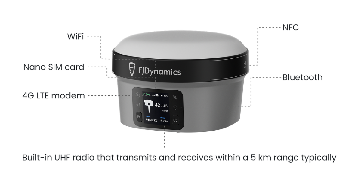
Built-in 4G LTE and UHF.
NFC, WiFi, Bluetooth
Clear Vision, Precise Measurements
The V10i RTK GNSS Receiver is designed to get the data you need even if the location is obstructed, dangerous, or inaccessible by foot. The powerful onboard processing software and 2 MP front camera with a global shutter seamlessly generate coordinates and measurements right on the field controller. View and save coordinate information with a few taps.
Safer Missions With More Control
AR Stakeout
You don't have to be in harm's way to get critical data, let AR Stakeout guide you in the field. Measure and stake out points by following simple illustrations on screen without losing situational awareness.
Tilt Compensation
Measure coordinates at survey-grade accuracy with robust IMU-based tilt compensation that requires no calibration, and no more watching the level bubble.
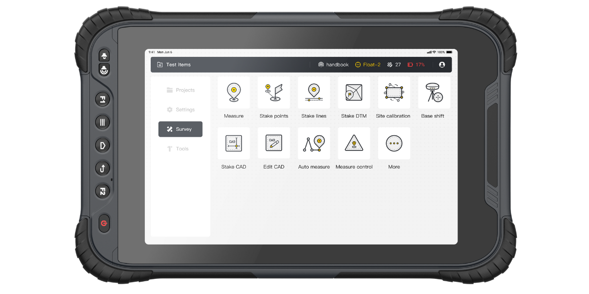
Field to Office
Enhance Productivity with Trion Survey Cloud for this visual positioning system. 2 GB free storage with purchase of V10i.
Field and Office in Sync
Seamlessly connect field and office teams. Transmit field data and project updates in real-time, expediting work on both ends. No more waiting, just productivity.
Easy Project Management
Share system parameters and set up data, including coordinate systems, geoid models, and datum grid files.
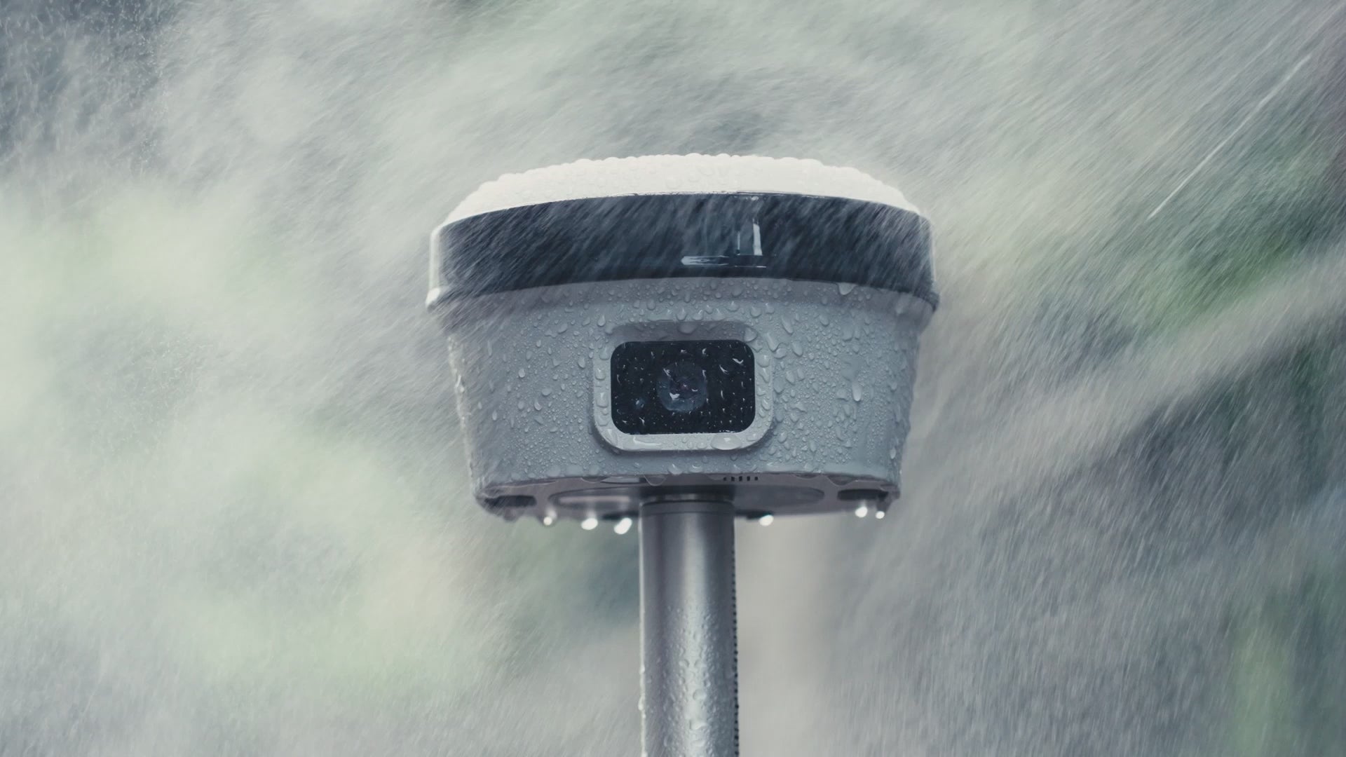
Built Tough, Engineered to Perform
The alloy body of the V10i is lightweight and resistant to magnetic interference. The upgraded build enables consistently strong satellite availability even with obstructed sky or less than ideal weather conditions. You can trust the V10i visual positioning system to keep on working even if it's rained on or dropped.
Stay Connected Wherever Your Job Takes You
Never worry about losing data transmission when you're in the field with this visual positioning system. Check connection status on the large, 350 nits OLED screen with a quick glance, even in direct sunlight.
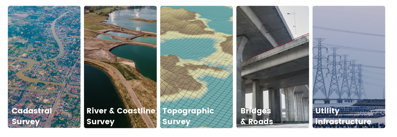
Application Scenarios
Accessories
FJD Trion Field Tablet UA80
- 8''Screen, HD 750nitst(type)
- Front 8MP, Rear 16MP
- BT5.0 @BLE
- IP67, 1.2m drop-proof
- Lithium-ion (3.8V/8200mAH) removable, 10h
- Support Google GMS certification (optional)
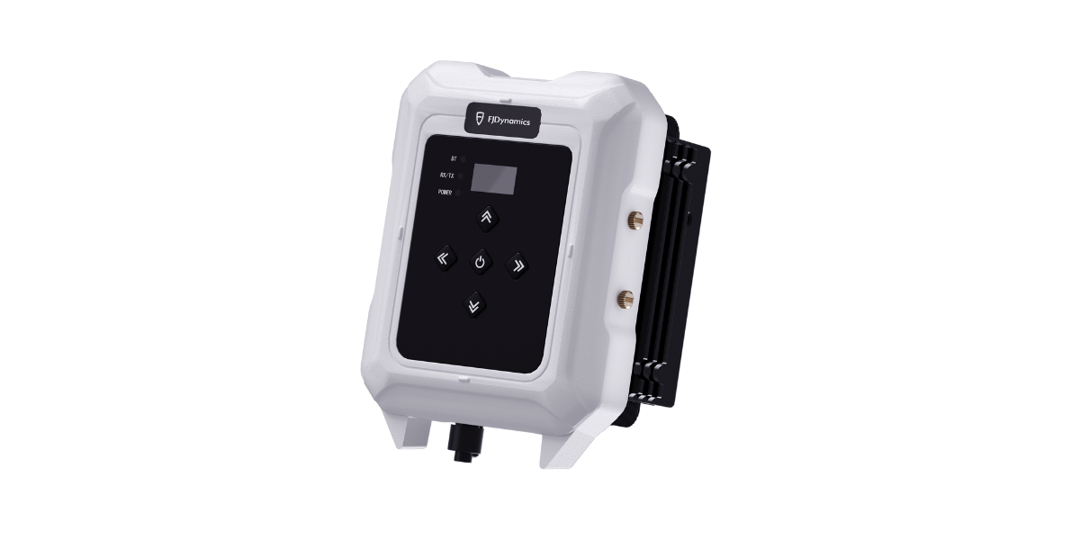
High Power External Radio
- Support for mutiple protocols: TRIMTALK, TRIMMARK III, TRANSEOT, and SATEL etc.
- Range: > 20km
- Multiple Channels, able to reprogram
- 9~16VDC,35W (85W)
- 2 kg, IP67
Specs
GNSS Performance
1408 channels
L1A, L1C, L2C, L2P, L5
L1, L2
E1, E5a, E5b, E6*
B1I, B2I, B3I, B1C, B2a, B2b*
L1, L2C, L5, L6*
L5*
L1*
Hardware
H: 8 mm + 1 ppm
RMSV: 15 mm + 1 ppm RMS
Initialization time: < 5 s
Initialization reliability: >99.9%
H: 2.5 mm + 0.5 ppm RMS
V: 5 mm + 0.5 ppm RMS
H: 0.4 m RMS
V: 0.8 m RMS
H: 1.5 m RMS
V: 2.5 m RMS
Typically 3 cm, range 2-15 m
1 Hz, 5 Hz and 10 Hz
Cold start: < 20s,
Hot start: < 5s
Signal re-acquisition: < 1 s
0-60°
30°/2.5 cm
Foward:2 MP, downward:5 MP
70°
Communications and Data Storage
Nano-SIM card
Integrated 4G modem: TDD-LTE, FDD-LTE, WCDMA, EDGE, GPRS, GSM
2.4&5 GHz, 802.11a/b/g/n/actouch pairing
NFC for device
BT4.2&BLE
7-pin LEMO port
UHF antenna port
USB Type-C port
Rx/tX:(410-470)mhZ / (902-928)mhZ
Transmit Power: 1W
Protocol: TRIMTALK, TRIMMARK III, TT450S, TRANSEOT,Satel 3AS 4FSK
Link rate: 9,600 bps to 19,200 bps
Range: 5-8 km typically
Input&Output:NMEA-1083、RTCM3.X
Input: RTCM2.X, CMR
32 GB internal memory
FAQ
Q1: Does V10i support 4G network?
Yes, V10i visual positioning system supports 4G network. It also supports Nano SIM card.
Q2: What is the function of the two cameras in V10i?
The front camera in V10i allows for image measurement, while the front and down-facing camera enables AR sampling.
Q3: What is the maximum tilt angle supported by V10i for tilt measurement?
The recommended maximum tilt angle is 60 degrees. The actual maximum tilt angle may vary depending on environmental conditions such as building obstructions, other electromagnetic interference, and ideal conditions (no interference) where it can measure up to 8km in communication distance.
Q4: Can V10i be paired with an external radio station for use? What is the working range of the external radio station?
Yes, the V10i RTK GNSS Receiver can be paired with an FJD external radio station for use. The working range of the external radio station still depends on environmental conditions; in ideal conditions (no interference), it can work up to 30km. In general conditions, it may range from 15-20km, and even less under severe interference conditions.
Q5: What is the built-in radio power of the V10i and the maximum power of an external radio station?
The built-in radio power of the V10i RTK GNSS Receiver is 1W, and the maximum power of an external radio station is 35W.